northwestedge.co.uk
paddling and hillwalking on the north west edge of Scotland.
CORVID-19 is still here and you are asked to be safe whilst out in the North West of Scotland. Current restrictions have been relaxed recently. Even so, please do not go out in the area if you are showing signs of Corvid-19. When out paddling or hillwalking make sure you give people space - 1m at least and preferable 2m. Remember that if it feels too crowded then you can walk away and try somewhere else; the environment will still be there tomorrow. Also remember the emergency services, the RNLI and the MRT. They will come out to rescue you but they should not have to put themselves into danger from this virus.
Take Care Out There.
Ascent of Cul Mor
| Cul Mor [NC162119, 849] | |
| OS map : | 15 |
| start : | A835 Knochan Crag |
| gridref : | NC189094 |
| summary : | A835 Knochan Crag - Cul Mor - A835 Knochan Crag |
| distance : | 10.0km. |
| ascent : | 620m. |
| time taken : | 4hr. 10min. |
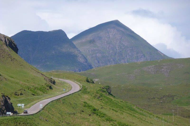
Cul Mor is one of the big hills of the North West of Scotlan within the Coigach area. Seen from the north west and south it grows steeply, and impressivly, from the wetlands around sea level. However, good news for the hill walker, from the east it meets the A835 at the Knochan Crag pass. The view of the hill from this side is still impressive but maybe not as much as the other sides. The view over the surrounding area is one of sheer remoteness. This is an acessible but remote hill, if that is not a contradiation.
Layby at the top of the A835 road at Knochan Crag. There is sufficient parking as this hill is not busy.
From the parking space, over the road there is a good stalkers track. This is followed high up into the hill. The start of the path is marked by a gate, and the path is clearly visible. Initially the path can be wet as it crossed the stream but soon the walker climbs the south east ridge of the hill. As with most stalkers paths this finds the best route up on the high ground. The path stops on the ridge just before Meallan Diomhaim but there is a fainter path climbing up this ridge. Do not climb Meallan Diomhaim but keep to the right, east, along the edge of the cliffs. Walk around by the small lochan and then west then south west to reach the summit. Effectivly contouring around the big U shaped corie. The summit is marked with a trig point and on a clear day there are fantastic views over to the hills of the North West, the fantastic coast and over to the Western Isles. (5kms. 620m. 2hrs. 50min.)
The return can be via the downhill route. Many hill walkers try to make a circular walk but in this area, on this hill, the views are so different it will not feel like a repeat of the way up. Follow the path around the cliffs north east then east to descent the south west ridge. From here the stalkers path is soon found and followed down to the road and car park. (5kms. 0m. 1hrs. 30min.)
© northwestedge.co.uk all rights reserved 2017-2025

